Natural counties and municipalities of Gran Canaria
Previously we talked about the history and geography of Gran Canaria, and in this article we will tell you about the natural regions and municipalities of Gran Canaria.
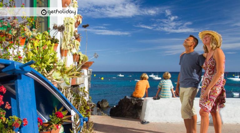
Las Palmas de Gran Canaria
It is the capital and with almost 400,000 inhabitants it is the most populous city in the Canary archipelago. In the center of the Vegueta neighborhood is the cathedral, on the south side the Patio de los Naranjos. Behind the cathedral is the Casa de Colón, and in front of the cathedral is Plaza de Santa Ana, where the town hall is located.
Nearby is the Canarian museum, which houses the largest historical and cultural heritage of the aboriginal world. Las Palmas has a variety of functions, mainly educational and cultural, as it is the seat of the university. The tourist function is also important.
It was founded in 1478 by the advanced Juan Rejón, in what is currently the neighborhood of San Antonio. Its commercial importance was enhanced with the creation of the Puerto de La Luz in 1871. Throughout the 20th century, the old city and the port have been joined, forming a very elongated plan.
On both sides of the capital there are beaches such as Las Canteras and Alcaravaneras. Behind the docks is the Castillo de la Luz. In this area is also the Santa Catalina Park.
Arucas
It is the most populated town in the north after the capital. It is a town of stone craftsmen where the church of San Juan Bautista, a neo-Gothic temple, is located. The industrial activity of Arucas is the distillery, which has a museum on the
production of that drink. The municipal museum or the garden of the Hesperides are other places of interest. Bañadero beach is also located in this area.
Teror
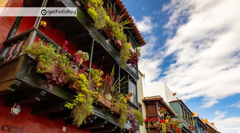
It is the center of pilgrimages on the island. The presence of the Virgen de Pino, several convents and religious buildings stand out in the area. The town preserves traditional Canarian houses with white facades and large wooden balconies.
The area near the Basilica has mansions such as the Casa Museo de los Patronos and the Plaza de Teresa Bolivar, declared historical-artistic heritage. Another place of interest is the Cister Convent.
The elaboration of chorizos, black puddings, egg bread and gofio nougat is traditional.
Firgas
The most popular mineral water springs in the Canary Islands were found in Firgas. The deforestation of this region gave rise to craft activities related to wood. Other artisan tasks are the elaboration of esparto espadrilles, embroidery, openwork, triperas and typical costumes.
Moya
Los Tilos Moya is the green town; Here is one of the most important laurel forest reserves. The municipality is wedged between the beds of the Azuaje and Osario ravines, which are highly visited by tourists due to their great variety of Canarian flora and bird species.
Galdar
The city of Galdar was the seat of the ancient kingdoms of the island: the Guanartematos. In the urban center of the archaeological park is the painted cave, which is one of the main finds of rock art in the Atlantic area and the most important in the Canary Islands. 5 km away is the port of Sardina beach.
Santa Brígida
High and low Tafira, was for centuries the center of production of the excellent mountain wine and today a residential and university enclave. This municipality, at present, is a mixture of the agricultural past and the residential present.
From its past we must allude to the large extensions of native plants: snapdragon, madroñal, pine forest, etc.
La Atalaya is an old village of caves and potters. Nearby is the golf course and the Caldera de Bandama.
EASTERN COUNTIES
Telde
The neighborhoods of Telde are in a good state of conservation. San Francisco and San Juan invite you to pay the utmost attention to their narrow streets, buildings and architectural details.
In its surroundings there are numerous archaeological sites. Telde is currently investing in the development of public infrastructures.
Valsequillo
At the end of the 16th century, a cavalry barracks was established, which is today one of the most important historical monuments of the place. The cultivation of flowers is important, being the main export area of the Canary Islands, as well as the production of artisanal cheeses.
Ingenio
Ingenio is known for its embroidery and handicrafts, exhibited in the Stone Museum, one of the first initiatives of the artisans aimed at tourism. On the border of this region with that of Agüimes is the spectacular Guayadeque ravine.
Agüimes
It was of great importance as an enclave for pre-Hispanic settlers (Roque de Aguayo, with several archaeological sites). In order to promote rural tourism, the old town hall and the Casa de los camellos have been rehabilitated; the same happens with the Caserio de Temisas, which is a set of Canarian houses, which have the largest olive grove in the Canary Islands.
SOUTH COUNTIES
Santa Lucia de Tirajana
In the town we find the Hao museum of prehistoric remains. Along the coast of Santa Lucia stretches Vecindario, Sardina and Doctoral; three nuclei that came together and is one of the areas with the greatest future on the island.
On the coast is Pozo Izquierdo, a beach where an important windsurfing event is held.
San Bartolomé de Tirajana
It is the largest municipality on the island and had fertile land from which all kinds of resources were obtained for years.
Its main activity is tourism, giving rise to the appearance of a great city for leisure: Playa del Inglés, Maspalomas, and Meloneras.
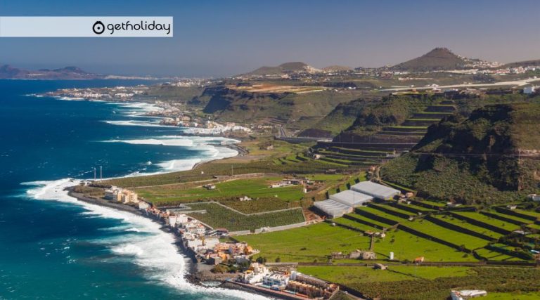
Mogán
We find the fishing and tourist port, and the area of the town dedicated to agriculture; thus offering two different ways of life. Puerto Rico is located in Mogán, one of the most important tourist areas of the island.
CENTER COUNTIES
Vega de San Mateo
Its agricultural market stands out, demonstrating the great agricultural activity in the area, also reflected in the Cho Zacarías ethnographic museum, one of the most complete in the Canary Islands.
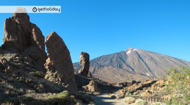
Tejeda
It has large Canarian pine forests, as well as a large colony of almond trees. Located in the center of the island, they are home to the Roque Nublo and the Roque de Bentáiga. Almond-based pastries are important.
Artenara
Small village located in the upper area of the island, reaching the coast, and surrounded by the forests of Tamadaba and Tirma.
The rocks and deep ravines stand out, and the appearance of dwellings-caves, where some peasants who preserve traditions such as ceramics still live.
Valleseco
From the great laurel forest there are remains of flora currently in recovery. Madre del Agua is a space characterized by having a great variety of native species, this area is highly visited by hikers.
The agricultural and livestock tradition in this area is important.
WEST COUNTIES
Agaete
The cliffs of Tirma and Tamadaba form the figure of what was the Finger of God. The three notable areas of Agaete are the valley, the port of Las Nieves and the town.
San Nicolas de Tolentino
Cliffs and ravines surround this area, which precisely has one of the highest flow ravines on the island. Tomato cultivation is the main activity of the municipality.